Welcome to Polytope's documentation!
Polytope is a data extraction service developed by ECMWF, which provides both access to full field global data and feature extraction capabilities. It uses concepts of computational geometry to extract n-dimensional polygons (also known as polytopes) from datacubes.
In particular, it can be used to request:
-
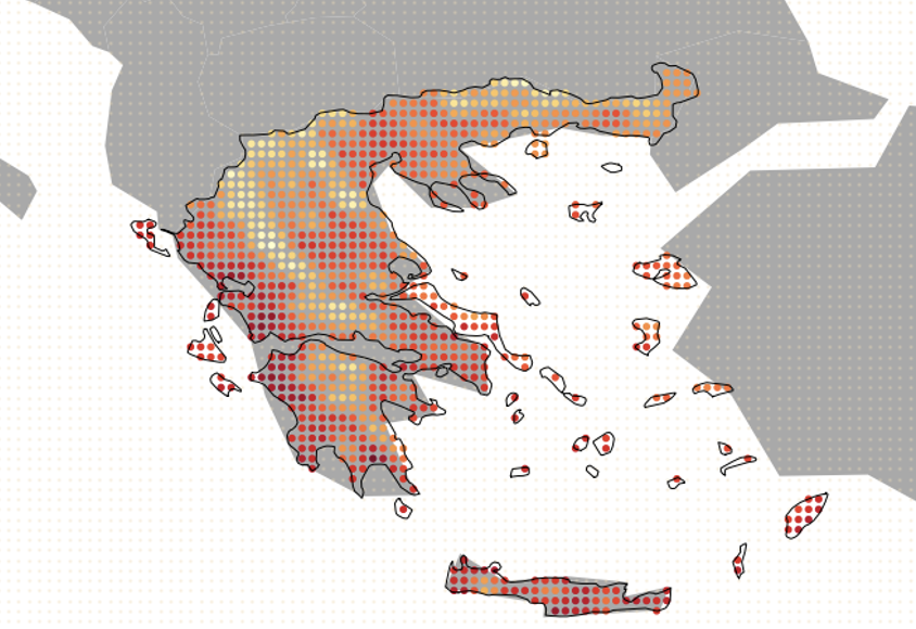
2D cut-outs, such as country cut-outs, from a datacube
-
timeseries from a datacube

-
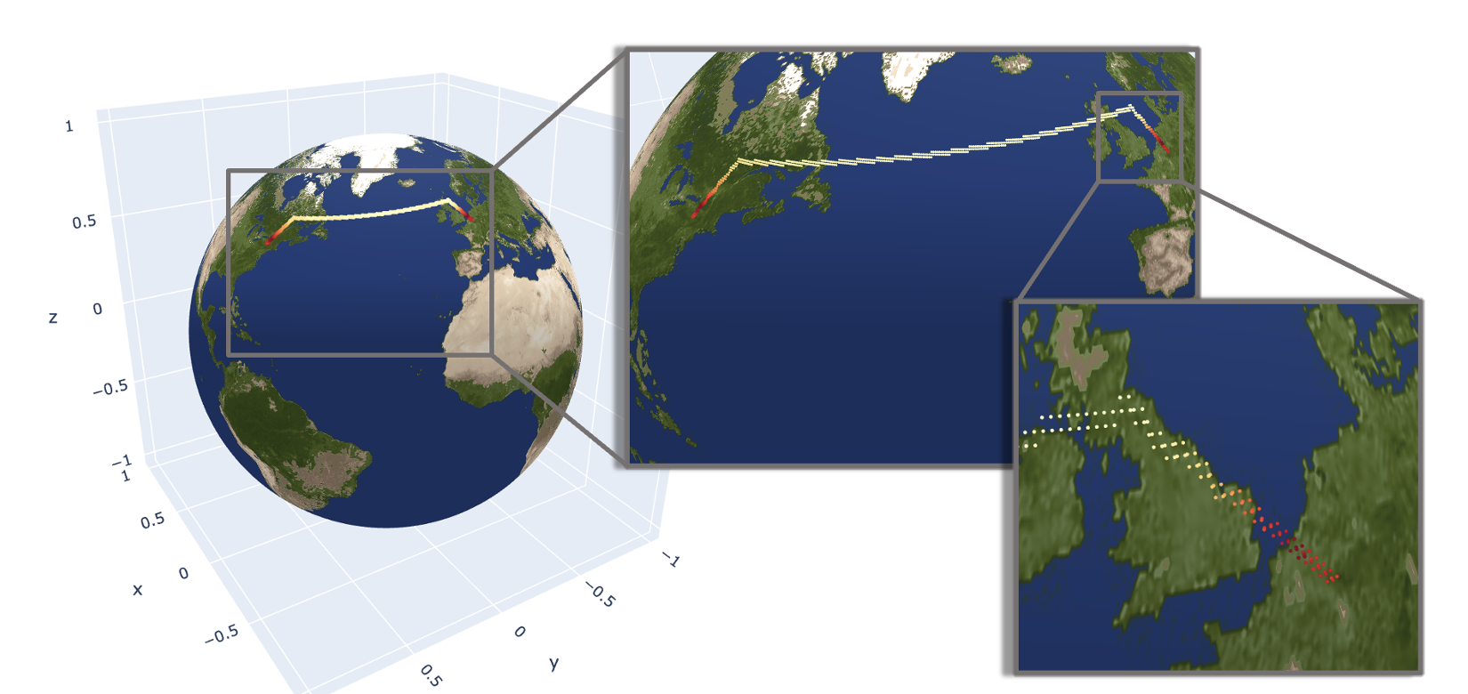
more complicated spatio-temporal paths, such as flight paths, from a datacube
-
and many more high-dimensional shapes in arbitrary dimensions, as well as global field.
Important
Note that Polytope Feature Extraction reads only the user-requested data, instead of whole fields. Importantly, this implies a significant decrease of the I/O usage when reading data from a datacube. Users can also leave out the feature dictionary to retrieve the whole field.
Polytope feature extraction consists of the algorithm itself, and the service that uses the algorithm to extract features from ECMWF datacubes. Details on the service can be found in the Polytope service overview, while details on the feature extraction algorithm can be found on the Polytope algorithm overview.
To learn more about how to use Polytope, refer to the Quickstart page. In particular, see the Quickstart page for a step-by-step example of how to use the Polytope software. For a more in-depth explanation of how Polytope achieves its feature extraction, refer to the Developer Guide.
Index
Service
License
Polytope is available under the open source Apache License. In applying this license, ECMWF does not waive the privileges and immunities granted to it by virtue of its status as an intergovernmental organisation nor does it submit to any jurisdiction.